About Broxtowe
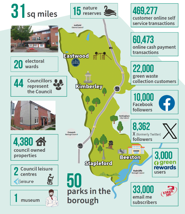
The Borough of Broxtowe lies to the west of the City of Nottingham and is bounded by the River Trent on the south and the River Erewash on the west. Broxtowe has a population of 110,900 people (2021 ONS census data) and covers an area of some 80 square kilometres.
Around 60% of the borough’s population live in the south of the Borough, which includes the main urban settlements of Attenborough, Chilwell, Beeston, Bramcote, Stapleford, Toton and part of Trowell. To the north, the Borough becomes more rural in profile with Eastwood and Kimberley being the largest settlements. All of the rural parts of the
Borough are within the defined Nottingham Derby Green Belt, which comprises 60.4% of the total Borough area.
The Borough has excellent access to the motorway network and good access to East Midlands Airport via junction 24 of the M1, together with excellent rail connections at Beeston and Attenborough stations and the close by Nottingham, East Midlands Parkway and Ilkeston Railway Stations. The M1 bisects the Borough, with junction 26 within the Borough at Nuthall, while junction 25 is just outside the Borough with links to Broxtowe and the City Centre via the A52.
Broxtowe in Numbers